| Pictures on this site are copyright George Flickinger. I have taken all pics unless otherwise noted, please email me for picture usage info. |
| . |

|
 |
 |
| Meteorologist George Flickinger's Storm Chasing Pictures and Southern Plains Forecasts |
| Flickinger Weather |
| Flickinger Weather |
 |
 |
| Meteorologist George Flickinger's Storm Chasing Pictures and Southern Plains Forecasts |
 |
| Flickinger Weather |
 |
 |
| This near softball-size hail had one hour to melt before I took this picture! See more photos from the tornado-producing storm here |
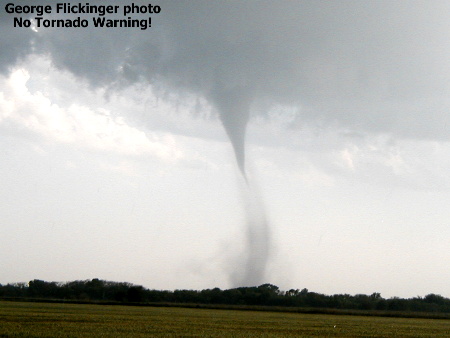
| I took this picture near Sharon, KS. This tornado was on the ground for 8 minutes before the Dodge City NWS issued a tornado warning-- the mesocyclone was quite small, making doppler detection more difficult. |
 |
| My wife took this photo...While chasing a tornado, me(blue shirt) and the crew jump out to pull this tree out of the road. An F3 tornado (shown next right) destroyed this area just minutes before |
 |
 |
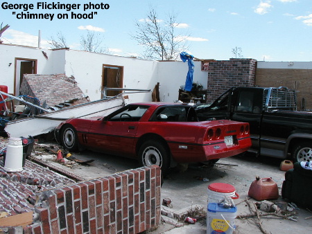
| An F2 rated tornado destroyed this home north of Bartlesville, OK in 2003. This photo is of the garage where these 2 vehicles were parked. That would be the chimney laying across the hood of the Corvette! |
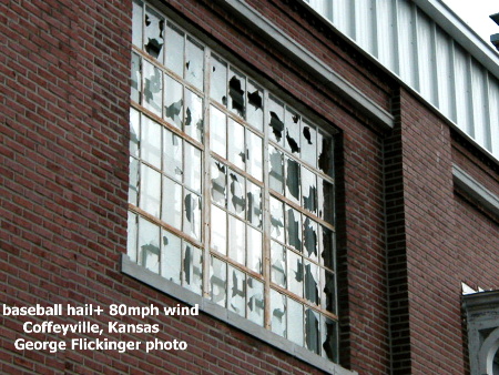
| Many structures lost their west windows when 80mph wind propelled baseball-size hail sideways. |
 |
 |
| Photo taken near Pryor, Oklahoma of a late day supercell. |
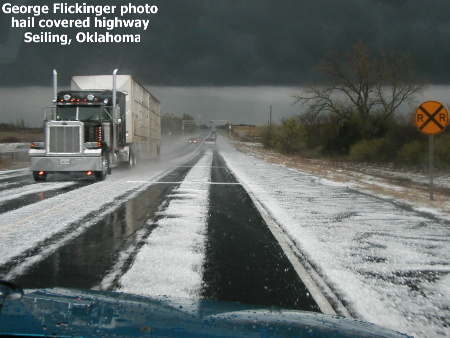
| As we drive toward this storm from the north, nickel-size hail covers the highway in Western Oklahoma. It looks like a winter ice storm! |
 |
 |
| This tornado was near a half mile wide at times. I took this photo just after sunset, hence the poor lighting. |
 |
 |
 |
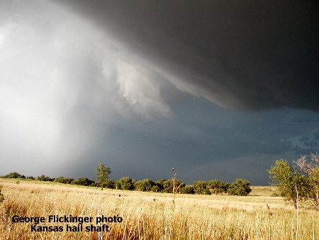
| I wouldn't drive into the white part!...We are about 2 miles south of a huge hail shaft. 1-3 inch thick hail is falling in the white area. |
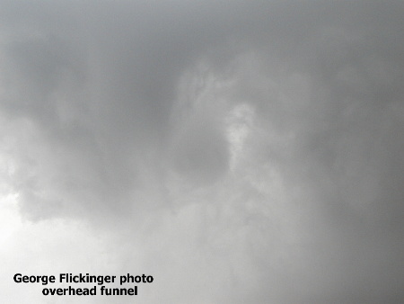
| See the small, circular gray area in the middle? I took this picture looking straight up of a storm trying to produce a small tornado. |
| A small, F1 type tornado touched down east of Oklahoma City. See more on these tornadoes here. |
| Here's a beautiful spring day near Alva, Oklahoma. Those clouds later produced tornadoes in Kansas. |
| An assortment of hail, hail damage, tornado, tornado damage and cloud pictures |
 |
 |
 |
 |
| Photo taken in Western Oklahoma. |
| A thunderhead towers above Kansas wheat. |
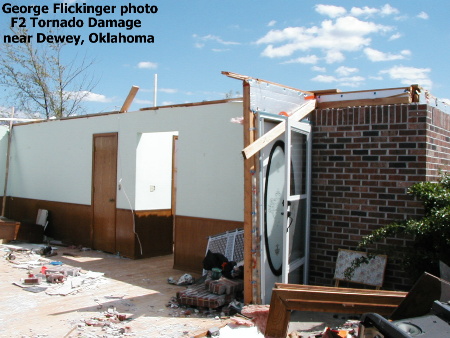
| Well, the front door is salvageable... The tornado lifted the roof off the house, causing exterior walls to fail. Winds were near 150mph. |
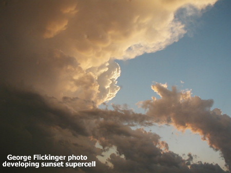
| These are the actual colors witnessed and photographed near the KS/NE border in Jun2, 2004. The storm looked inpressive, but never tornadoed. |
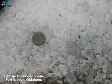 |
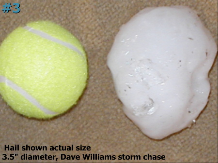
| Look inside these hailstones, and you can see the different freezing layers. This photo shows well how hailstones grow in size with each trip up the updraft. |