| Pictures on this site are copyright George Flickinger. I have taken all pics unless otherwise noted, please email me for picture usage info. |
| . |
 |
 |
| Meteorologist George Flickinger's Storm Chasing Pictures and Southern Plains Forecasts |
| Flickinger Weather |
| Flickinger Weather |
 |
 |
| Meteorologist George Flickinger's Storm Chasing Pictures and Southern Plains Forecasts |
 |
| Flickinger Weather |
 |
 |
| I'm out of position on this Tornado Warned storm. A tornado occurred about 15 minutes ago. The storm is 25 miles east of me and I have no chance to catch it as it's moving away from me. Typical of the early season, the storm is extensively sheared. |
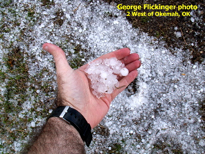
| But I drive toward the storm anyway and come across the hail covered ground. Lots of smallish hail makes for icy driving! |
 |
 |
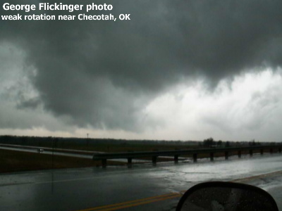
| Looks more impressive that it is... I'm on Interstate 40 at exit 270 looking north at weak rotation. A tornado warning is in effect for this storm. Surface inflow is weak and the storm is outflow dominate. |
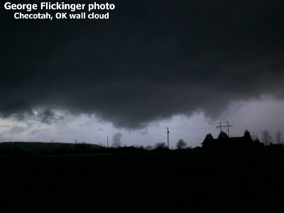
| Here's a pseudo- wall cloud between Checotah and Warner. Again the storm looks scarier than it is. |
 |
 |
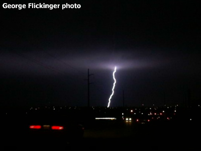
| And finally a little lightning strike that night in Tulsa. |
 |
| Not bad for my first chase of 2005! |
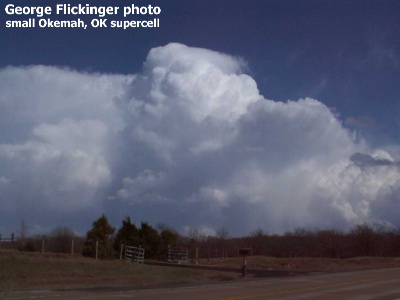
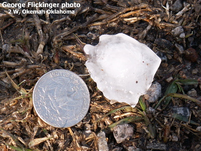
| I took this photo from Highway 62 west of Okemah. I found a few hailstones larger than 1 inch. |
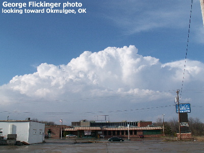
| After a quick live TV report in Henryetta, I snapped a picture of the storm. It's about 30 miles north of me. The anvil is near peak height. The storm then weakened as it moved into cooler air near Tulsa. |
| March 21, 2005 NE Oklahoma: Some Hail, Some Tornado Warnings |
| The first severe weather outbreak of 2005 provided a few small tornadoes in Oklahoma and hail. I provided live reports and video for TV. The storms were hard to chase, typical early season fast movers. |